PLACES TO VISIT
The Best of New Zealand

| home |
| itineraries |
| photos |
| places to visit |
| buy new zealand |
| travel offers |
| contact |
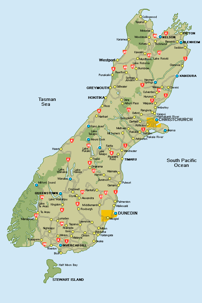
|THE SOUTH ISLAND...Go to | (Click on the blue dots to find out more! |
|
|

|
Nelson, located near the centre of Tasman Bay at the north of the South Island, is the gateway to Golden Bay and to Abel Tasman National Park. It is also in the centre of a thriving wine and food region.
Crafts abound in the Nelson area. The rings for the Lord of the Rings trilogy were made in Nelson by craftsman Jens Hansen (you can find him at 320 Trafalgar St, Nelson) and the wonderful Höglund Art Glass – International Glass Centre is just 20 minutes drive from the centre of Nelson. And don't forget to have a look at the World of Wearable Art (WOW!) Gallery and Classic Car Gallery while you are there! That's just for starters... Nelson is centrally located at the top of the South Island making it easy to travel to Picton in the Marlborough Sounds, Blenheim (heart of Marlborough, New Zealand's best wine country) or Golden Bay within 90 minutes. It is only two hours to drive to the Nelson Lakes National Park and the northern-most skifields in the South Island. For more information visit Nelson's i-Site Visitors' Centre on-line or: PHYSICAL ADDRESS POSTAL ADDRESS DDI +64 3 548 2304 We can recommend Kaiteriteri Beach north of Motueka (a leisurely hour's drive from Nelson), having had lovely beach holidays there swimming, relaxing on the golden sandy beach, boating or fishing. Scallops abound off the beach at the right time of the year. We know, because we have caught them! Further up the peninsular are bush walks, a marine sanctuary and dozens of secluded beaches. A paradise for walkers, kayakers or boaties.
If you have three to five spare days, then the 80 kilometre (50 mile) Heaphy Track starts near Collingwood and winds its way down to Karamea on the West Coast. A truly great walk. If you want a 'green rush', then think about the Heaphy Track.
|
|||||||||||||||||||||
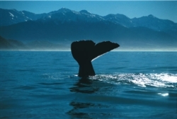
From Blenheim, it is a leisurely half hour drive to Picton and the Marlborough Sounds. Alternatively, it is about an hour and a half's drive to Kaikoura where you can take a flight or a boat to go watching whales just off the coast. On the way to Kaikoura look out for fresh crayfish (New Zealand lobster) from stalls on the side of the road or visit seal colonies that are right by the road at several points.
From Blenheim you can also gain access to Molesworth Station, which at 180,476 hectares in area (approx. 500,000 acres, or over 700 square miles) is New Zealand's largest farm. The scale of the place is unfathomable and the scenery simply spectacular. Molesworth Station is open to the public by way of the Acheron Road from 28 December to 1 April, from 7.00am to 7.00pm but weather conditions or fire danger can cause the road to be closed without warning. It is also unsuitable for certain types of vehicles (e.g. buses, long vehicles or caravans). You can drive right down to Hanmer Springs weather and road conditions permitting, but you need to allow time - the road is not exactly a state highway! Another option is to plan a tour with one of several operators that organise tours through Molesworth Station . We can help with these.
|
|||||||||||||||||||||
If you would like to do so, book a trip to see them. You can fly by fixed wing aircraft, helicopter or take a boat trip. If you would rather, you can book a trip to swim with the dusky dolphins. From Kaikoura you can travel south to Christchurch or straight through to Hanmer Springs. Be warned, though, the route from Kaikoura to Hanmer was gravelled rather than tar-sealed for part of the way last time we were on it. Unlike in the UK this is unfortunately a quite common feature of New Zealand back- country roads. It adds to the charm, but it does make your teeth rattle!
|
|||||||||||||||||||||
|
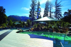
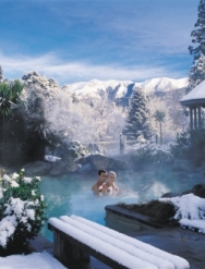
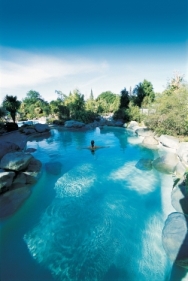
We think these are the best thermal pools in New Zealand; Hanmer is a gem of a place that is often missed by tourists from overseas. The springs come from deep within the earth and are at varying temperatures from 36 degrees Celsius in the chlorinated rock pools to 42 degrees (and unchlorinated) in the sulphur pools. It is a large complex and we have often travelled the two hours from Christchurch to Hanmer for a soak for the day. One of our most magical memories was soaking in the pools in the middle of winter with snow falling gently all around us. Absolutely beautiful. To make the most of Hanmer there are a large number of walks - the Conical Hill walk is our favourite. It winds its way up through a conifer forest to give a terrific view of the surrounding countryside.
If you prefer a more exhilarating end to your visit, leaving Hanmer to the south is a high bridge over the Waiau River from which Thrill Seeker's Canyon, a bungy jumping firm operates (they also offer jet-boating on the Waiau River and river rafting as well). We know it well: the sixteenth birthday of one of our children was spent bungy jumping off that bridge! And of course in winter there is always the ski field just above the township at Hanmer... |
|||||||||||||||||||||
|
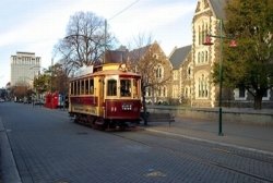
Christchurch is our favourite city in New Zealand. The first people to live in the area were Maori about 1,000 years ago. They hunted large flightless birds named moa, some of which were larger than ostriches. Further migrations of Maori continued until the 1830s. In 1850-51 the first organised settlements of English settlers landed on the four ships Randolph, Cressy, Sir George Seymour and Charlotte Jane left England in September 1850 and arrived in New Zealand in December 1850. The city was established by royal charter in July 1856. Today about 350,000 people live in Christchurch which is the lead city of the Canterbury Province inhabited by over half a million people. The strong English influence pervades Christchurch to this day. Even today many fifth generation Christchurch-born New Zealanders talk with an English accent. The architecture and gardens have a strong English 'feel'. In fact, Christchurch is known as New Zealand's 'garden city' with good reason. There is so much to do in Christchurch. Here are some suggestions... Arts Centre. Formally Canterbury University, the Arts Centre has a wide variety of arts and crafts represented. There are good restaurants. Try Annie's Wine Bar, or for a more relaxed studenty feel, try the Dux de Lux (restaurants, bars and brewery) and a huge variety of cheap ethnic food served in mobile caravans on the south side of the complex. From the Arts Centre you can hop on a tram and take a tour of central Christchurch - a good way to see the centre of town - especially because you can buy a ticket that lets you get on and off as much as you like and lasts for two consecutive days.
Hagley Park. This lovely park covers 21 hectares (52 acres) and is right in the centre of Christchurch. You can walk through it or around it, run it, cycle it or play golf in it - yes there is a golf course in the centre of Christchurch! Christchurch botanical gardens are located there - just across the road from the Arts Centre and adjacent to the Canterbury Museum.
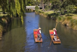
Wining and dining. There are many fine restaurants in Christchurch. Some of the most accessible are along 'The Strip' one block west of Colombo Street - Christchurch's main road - and adjacent to the lovely Avon River which wends its way through the city. The food is reasonably priced and beautifully presented and Italian, Asian (Chinese, Japanese, Thai, Indian and Korean), French, European and American are all represented. New Zealand seafood is the best in the world. As for the wine, try a New Zealand Sauvignon Blanc or Pinot Noir to accompany your meal. Port Hills. Overlooking Christchurch to the south are the Port Hills. Of volcanic origin, along with the whole of Banks Peninsula of which they are a part, they provide a magnificent vantage point from which to view Christchurch, Lyttelton Harbour, the whole of the Canterbury Plains and the Southern Alps. If you have a rental car drive to the southern end of Colombo Street, cross the round-about and head on up the Dyers Pass Road until you reach cross roads at the summit. Turn a sharp left and continue along the crater rim. There are plenty of places to pull off the road and park. You will want to ramble so take a good, strong pair of shoes. If you continue east you will eventually come to an intersection. Turning right takes you down to Lyttelton Harbour from whence you can take the Lyttelton tunnel back to Christchurch. Turning left takes you down to Sumner Beach where you can follow the coast road back into the centre of Christchurch. While in Sumner make sure you take a stroll along the Esplanade.
Antarctic Centre. Located adjacent to Christchurch International Airport, the Antarctic Centre is a museum of the Antarctic. Since 1955 Christchurch has been the US Operation Deep Freeze base for flights to and from the Antarctic and is the departure point for aircraft leaving for New Zealand's Scott Base. The centre is well worth a look. For more information visit Christchurch's i-Site Visitor Centre on-line or: Further afield Mount Hutt Ski field. We have many fond memories of family skiing days on Mt Hutt which is so accessible from Christchurch. You can drive direct from Christchurch in about an hour (driving to the field itself can take another hour on top of that). Alternatively, Methven is a good place to stay for accessibility but book early! Compared with European prices skiing in New Zealand is cheap and with a strong pound or Euro you can't lose! Banks Peninsula. When Captain Cook first visited New Zealand in 1769 the map he drew of New Zealand had what we now know as a peninsula (and which he named after the botanist Sir Joseph Banks) drawn as an island. He was nearly right. The peninsula was once (albeit eons ago) a volcanic island - one of the few areas of volcanicity in the South Island, and now long since extinct. As the flood plains of the braided South Island Rivers coalesced and extended out to sea, Banks Island became joined to the mainland. The harbours around the peninsula of which Lyttelton and Akaroa are only two, were formed when volcanic caldera collapsed and were flooded by sea water. Take your time as you drive the 87 kilometres from Christchurch to Akaroa. Allow two hours for the journey because the road winds its way up and over the summit ridge. On the way you will pass Lake Ellesmere, a huge salt water lake enclosed by the Kaitorete Spit, Lake Forsyth (Lake Wairewa) and Little River. Stop off at Little River for a cup of coffee in the Little River Gallery. If it is a clear day as you travel up the ridge overlooking Akaroa, you should be able to make out Mount Herbert (3,014 ft or 918 metres), Mount Fitzgerald (2,710 ft, 826 metres), and Mount Sinclair (2,763 ft, 842 metres), the last-named lying just outside the Akaroa basin. Travelling down the other side, stop in at the Barry's Bay Cheese Factory - our favourite is the Maasdam cheese filled with large holes and which has a wonderfully sweet, nutty flavour. On the right just before you get to Barry's Bay you can travel up to French Farm where there is a vineyard. Before you get to Devauchelles there is a narrow spit of land culminating in a tear-drop shaped terraced headland rising to over 100 metres. Named Onawe Point it was the site of the Takapuneke Maori fortified village or pa. In 1832 the infamous Maori warrior chief Te Rauparaha, colluding with a dubious sea captain named John Stewart of the brig Elizabeth, captured the paramount chief Te Maiharanui and massacred over 200 Maori inhabitants of the pa. This incident hastened the signing of the Treaty of Waitangi in 1840 between the British Crown and representatives of Maori clans. Follow the road round to the south through Devauchelles and thence to Akaroa. Don't worry too much if it rains, which it is quite likely to do - all those hills do attract the weather and there is nothing between them and the Antarctic should a southerly wind decide to blow, so wrap up warm!
|
|||||||||||||||||||||
|
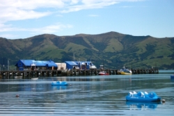
Akaroa was the first French settlement in New Zealand.
A little history In 1838 Captain Langlois, a French whaler, sought to set up a port at Akaroa to service whaling ships. After a shady land deal with the local Maori he returned to France, founded the Nanto-Bordelaise company, and sailed for New Zealand with a group of French and German families aboard the Comte de Paris to found a French colony in the South Island of New Zealand. However, by August 1840 when Langlois and his would-be colonists arrived at Banks Peninsula, governor Hobson had already presided over the signing of the Treaty of Waitangi (the signatories including two chiefs at Akaroa in May) and New Zealand had been claimed for the British Crown. Hobson quickly dispatched HMS Britomart from the Bay of Islands to Akaroa with police magistrates on board when he heard that the arrival of the French colonists was pending. While the French languished in unfavourable weather at Pigeon Bay on the north side of Banks Peninsula, the Union Flag was raised at Greens point between Akaroa and Takapuneke asserting British sovereignty over the South Island. Today... many of the street names are still in French and it retains an old world charm that is quite seductive. We have many fond memories of family holidays in Akaroa. Make sure you buy a meal of fish and chips at Akaroa Fish & Chips (59 Beach Rd, Akaroa) - they cook the freshest fish in the world. And for sheer charm, visit Tree Crop Farm. If you have time go for an Akaroa Harbour Cruise on the Canterbury Cat. You are highly likely to see the Hector's dolphin the rarest dolphin in the world - a cutie at its maximum adult length of 1.2-1.4 metres (compared with 4 metres for the bottlenose). And you will also see fur seals, salmon and mussel farms and a wide variety of wildlife. If you want to swim with the dolphins try Dolphins up Close on the main wharf in Akaroa. There is a marvellous Ngai Tahu Maori meeting house at Onuku, a few bays round from Akaroa. For more information about Akaroa, try: Contact: Akaroa Visitor Centre |
|||||||||||||||||||||
|
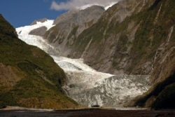
Franz Josef There are several options for getting there. Our favourite is the Trans Alpine Rail crossing from Christchurch to Greymouth via Arthur’s Pass. It is deservedly one of the world’s great rail journeys – not because of its length (it only takes four and a half hours to make the crossing) but because of the scenery on the way. Driving the Arthur’s Pass from Christchurch to Greymouth is also a good alternative. Contrasting with the dry rain shadow country east of the Southern Alps, the West Coast is wet, so be prepared for days of rain with a good, warm raincoat. Try not to be too disappointed if you cannot see the lovely scenes in the tourist brochures! A lovely Maori story gives the origin of Franz Josef glacier. Known in Maori as Ka Roimata o Hinehukatere (the tears of Hinehukatere), Hinehukatere loved to climb the Southern Alps with her lover Tawe. When the less experienced climber Tawe fell to his death, Hinehukatere wept and her copious tears froze to form the glacier.
Fox Glacier to Wanaka via the Haast Pass |
|||||||||||||||||||||
|
The finger-like basins of lakes Wanaka and Hawea were carved out by glaciers. Only quarter of an hour separates them in travelling time and it is only an hour’s drive from either lake to Queenstown
For more information visit Wanaka's i-Site Visitor Centre on-line or: For more information about Wanaka, try: Contact: Wanaka Visitor Centre |
|||||||||||||||||||||
|
Queenstown has so much to offer. Yes, it is commercial, touristy and busy. But for all that, it is an area of unsurpassed beauty. To get the best persective on this take the road from Wanaka over the Crown Range (not forgetting to stop off at the Cardrona Hotel on the way) but be warned - this is the highest main highway in New Zealand reaching 1119 metres above sea level and can be hazardous in winter. Taking this route is much shorter in distance at 70 km (44 miles) than the alternative route (120 km/75 miles) through Cromwell but it will take you about the same time when you take into account the stops for photos and twists and turns on the route.
Getting there. You can drive, pedal a bike, take a bus or fly (Queenstown has its own international airport and connections are good to the most popular tourist spots in New Zealand). The roads are good but can be icy in winter, so be careful. When you get there, make sure you take the Skyline Gondola up the top of Bob's Peak for a spectacular view of Queenstown, Lake Wakatipu and the Remarkables. Looking south you can see Queenstown Hill (902 metres - 2958 feet) out to the left and Cecil Peak (1,974 metres - 6477 feet) and Walter Peak (1815 metres - 5956 feet) out to the right. As you will see, the city of Queenstown sits on the northern edge of Lake Wakatipu about where its inverted 'z' shape begins its final swoop southward. The lake was carved out by glacial action during the last Ice Age about 15,000 years ago and lies in a basin overlooked by the nearby Remarkables Mountain Range. Lake Wakatipu is nearly 400 metres (1,200 feet) deep at its deepest point, covers 290 square kilometres and is 84 kilometres long. There are good skifields nearby including Cardrona, Coronet Peak (1658 metres) and the Remarkables (highest point is Double Cone at 2343 metres- 7844 feet). A celebration of all things winter called the Winter Festival takes place in Queenstown in June and July and is not to be missed! In 1988 AJ Hackett made Queenstown the world home of commercial bungy jumping. We dare you!
Forty kilometres from Queenstown and at the northernmost tip of Lake Wakatipu, is the township of Glenorchy (population 200). You have the option from Glenorchy of taking a flight to Milford Sound (weather permitting), beginning the world class Routeburn (32 kilometres and 3 days) , Greenstone, Caples, Rees or Dart Valley walking tracks, or taking tours of locations where the Lord of the Rings movies were shot. Other things to do:
For more information visit Queenstown's i-Site Visitor Centre on-line or:
|
|||||||||||||||||||||
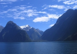
Rudyard Kipling once described Milford as the eighth wonder of the world for good reason. Here everything must be conveyed in superlatives:
Milford and Doubtful Sounds are in reality u-shaped glacially cut fiords from which the glaciers responsible have long since receded. The tributary glaciers flowing into these valleys have also receded leaving hanging valleys from which waterfalls often now descend. The jagged mountain shapes have been carved by the combined action of continued up-thrust due to the collision of the Pacific and Australian Plates and the sculpting action of wind, ice and water. Getting there
Things to do
|
|||||||||||||||||||||
|
Invercargill Things to do
For more information visit Invercargill's i-Site Visitor Centre on-line or: Southland Museum and Art Gallery |
|||||||||||||||||||||
|
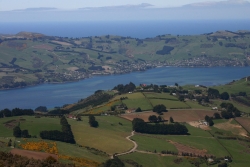
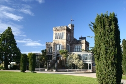
Dunedin
Visitors often remark on the richness of the Victorian and Edwardian (and even Jacobean-style) architecture in Dunedin, albeit with a colonial 'flavour' which makes the city quite distinctive. if you go to Dunedin, be prepared for squally and changeable weather - especially in winter. When the wind whistles up from the south there is little to stop it bringing the biting cold up from Antarctica. Things to do
Further Afield -Day Trip 1 You can do the following 'round trip' in one day* (takes a minimum of 5 hours):
*But the day will probably be a long one! Further Afield -Day Trip 2. Allow a minimum of 5 hours for this journey. Part of the trip takes you along a narrow gravel road, so exercise care and discretion. But the scenery is out of this world:
There are plenty of other day trips you can do from Dunedin. We have suggested just one. If you would like more information this can be provided for you as we work with you to develop your itinerary.
For more information visit Dunedin's i-Site Visitor Centre on-line or the physical address which is open 365 days a year: Dunedin City Council - Customer Services Phone: 03 477 4000
|
|||||||||||||||||||||
|
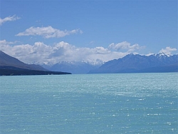
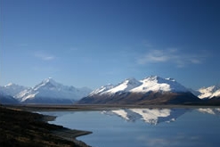
The Mackenzie Country We have devoted so much space to this area because we love it so much! We hope that you will see why... The splendid turquoise-coloured twin lakes Tekapo and Pukaki (and their southern counterpart, Lake Ohau) lie in the Mackenzie Basin - a geological feature resulting from glacial action that ended about 15,000 years ago. Bounded by limestone 'downland' to the west and the Southern Alps to the east, the 'Mackenzie Country' or just 'the Mackenzie' as it is colloquially known has a raw, bleak beauty that changes remarkably with the seasons. Covered in distinctive clumps of tussock grass and thorny matagouri, in summer it is semi-desert, while in winter it is blanketed by snow. The turquoise waters of Lakes Tekapo and Pukaki and the great rivers crossing the Canterbury Plains are the result of 'glacial flour' - finely ground greywacke rock ground into fine particles and held in suspension.
Access to the Mackenzie Basin is primarily via Kurow and Omarama (heading from the south and west), the Lindis Pass and Omarama (from the south) and via Fairlie and Burke's Pass (from the north and west). The Mackenzie Basin was named after a legendary Gaelic-speaking Scot named James Mackenzie who was captured in March 1855 in the pass bearing his name with 1,000 sheep from the Levels sheep station north of Timaru. He was sentenced to five years' hard labour for sheep stealing, but escaped in May and June 1855 and was recaptured both times. Subsequent investigation by a magistrate in Christchurch found flaws in the police case and Mackenzie's trial and he was pardoned in 1856. However, Mackenzie became something of a folk hero and his name will be forever inscribed in kiwi folklore. Omarama The town that is the southern gateway to the Mackenzie Basin is world famous for gliding. Wonderful conditions for gliding are created by the powerful wave clouds, clear air and thermals rising over the Southern Alps. These produce some of the best conditions and most spectacular scenery in the world for soaring. If, instead of heading north, you take the road east and then south east to Sailors Cutting (less than ten minutes' drive) or Otematata (about 25 minutes away) you have good access to Lake Benmore, New Zealand's largest man-made lake which covers 75 square kilometres. If you are reach Otematata, turn left and head north to Benmore township. It is wonderful for water skiiing and a variety of other water sports. And its brown and rainbow trout and salmon fishing is one of its drawcards. On the eastern side of the lake are two of New Zealand's largest and most famous sheep and cattle farms, Haldon and Black Forest stations which between them cover in excess of 70,000 acres (about 30,000 hectares). Various treks are available that take you through this area.
Alternatively, head north out of Omarama and after about ten minutes take the turn-off to your left to Lake Ohau which, because of its spectacular scenery and wonderful skifield, is a highly recommended detour. You get a real 'feel' for what living on a New Zealand high country farm might be like. Twizel About 25 minutes north of Omarama is the town of Twizel (the i sound is long, not short - it doesn't rhyme with fizzle!) which was built as a construction town in the 1960s for the Upper Waitaki Power Development - the largest hydro scheme ever undertaken in New Zealand. It was not meant to survive as a town once construction was finished, but local residents campaigned for it to continue and it has remained as a thriving service town of 1,200 people to the farming, sport and tourist industries. Lake Ruataniwha (that is the lake you can see from State Highway 8) is Twizel's lake and is one of the top venues in New Zealand for rowing. But it is not Twizel's only attraction. Walking, hiking, climbing and fishing for trout and salmon are just some of the activities that are easily accessible from this town. It is a great place to stay en route to Mt Cook (or Aoraki as it is known in Maori) - New Zealand's highest mountain. Lake Pukaki Twizel to Lake Tekapo is a non-stop drive of about 40 minutes. You will not want to do that because there is plenty to see on the way. Not even ten minutes out of Twizel heading north you come to Lake Pukaki. Stop at the scenic lookout spot on the way. Here take the time to drink in the colour of the lake and (if it is a good day, which it frequently is) a magnificent view of Mt Cook at its apex.
From there, take the signposted canal road which follows the route of the hydro canal from Pukaki to Tekapo instead of State Highway 8. On the way you will notice Mt Mary, an imposing landmark out to your right. In only a few minutes you will come to a salmon farm which breeds the healthiest, fattest salmon in the world. On the banks of the canal on the downstream side of the salmon farm is a good place to fish for big trout because the excess feed from the salmon farm is washed down the canal and devoured greedily by all the other fish wanting a 'free lunch'.
Lake Tekapo Before you know it you will arrive at Lake Tekapo. Just breathe in that clear mountain air or take a paddle in that milky blue (and freezing cold) lake. We suggest taking the path from Tekapo township and climbing the 300 metres to Mt John. The trek will take you 2 and a half to three hours but if you take the trouble you will be rewarded with 360 degree views of the surrounding countryside. While at the summit, have a cup of coffee in the glass-walled Astro Cafe and take a look at the observatory which houses a 1.8 metre astronomical telescope, the largest in New Zealand. Mt John was chosen as an observatory site for the naturally dark skies above the Mackenzie Basin which are devoid of polluting light, its very clear nights and the stable and transparent atmosphere. There are four main telescopes at the summit each housed in its own dome. We can thoroughly recommend taking an Air Safaris flight from Tekapo airstrip over the Southern Alps. Just do it!
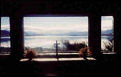
While in Tekapo make sure you visit the iconic Church of the Good Shepherd. There is much to take in Lake Alexandrina Mt John
|
|||||||||||||||||||||
Mt Cook - under construction |
|||||||||||||||||||||